Skip navigation links
Smartwatches
Products
All Wearables & Smartwatches
Outdoor Watches
Running Watches
Trail Running Watches
Indoor Training Watches
Multisports & Triathlon Watches
Diving Watches
Swimming Watches
Golf Watches
Watches for Women
Fashion & Hybrid Smartwatches
Fitness & Health Tracking Watches
Garmin ECG App
Contactless Payment Watches
Watches with Music
Watches for Kids
Marine Watches
Aviation Watches
MARQ Luxury Watch Collection
Discontinued
Selection Guide
Find The Perfect Watch For Me
Watch Comparison
Watch Size Guide
Why Garmin Watches?
Subscription
All Subscription & Service Plans
Accessories
Garmin Connect
Connect IQ
Garmin Express
Garmin Sports
All Apps
Maps
Outdoor Map Update
Golf Map Update
Golf Course Locator
Explore Features
Garmin Technology
Garmin Coach
Garmin Solar Technology
Garmin Pay Contactless Payment
Third-Party Music Provider
Garmin Blog
Garmin Communities & Events
Garmin Run Club
Garmin Cycling Club
Garmin Marathon Series
Sports & Outdoor
Products
Outdoor Watches
Running
Trail Running Watches
Indoor Training Watches
Cycling
Tacx Indoor Cycling
Multisport & Triathlete
Diving
Swimming
Golf
Handhelds
Sportsman & Tactical
Discontinued
Health Monitoring Products
Scales & Monitors
Index Sleep Monitor
Subscription
All Subscription & Service Plans
Apps
Garmin Connect
Connect IQ
Garmin Express
Basecamp
Garmin Sports
All Apps
Maps
Outdoor Map Update
Cycling Map Update
Golf Map Update
Golf Course Locator
Explore Features
Garmin Technology
Garmin Coach
Garmin Solar Technology
Tacx Technology
Garmin Pay Contactless Payment
Third-Party Music Provider
Garmin Blog
Garmin Communities & Events
Garmin Run Club
Garmin Cycling Club
Garmin Marathon Series
Extended Services
Garmin Health Enterprise Solutions
Auto & Home
Products
Motorcycles
Dash & Backup Cameras
Car Audio
Home Audio
Discontinued
Apps
Garmin Express
All Apps
Maps
Automotive Map Update
Explore Features
Garmin Blog
Automotive OEM
Automotive OEM Solutions
Marine
Products
Commercial Fishing
Chartplotters & Fishfinder
Sonar Modules
Live Sonar
Engine Cutoff / MOB
Trolling Motors
Transducers
Radar
Autopilots
VHF & AIS
Instruments
Wind Sensors
Sailing
Antennas & Sensors
Audio
Digital Switching
Handhelds & Wearables
Networking
Marine Cameras
All Apps
Discontinued
Selection Guide
Which Marine Products are right for you?
Marine Product Brochure Download
Subscription
All Subscription & Service Plans
Apps
Garmin Express
Software Updates
All Apps
Charts & Maps
Purchase New Charts
Charts (Non Garmin Chartplotter)
Discover Daily Updates
Explore Features
CHIRP Sonar Technology
Engine Integration
OneHelm
Garmin Blog
Aviation
Markets
General Aviation
Business Aviation
Experimental
Helicopters
Government & Defense
Products
ADS-B & Transponders
Flight Decks
Flight Displays and Instruments
Engine Indication Systems
Navigation & Radios
Autopilots
Audio Panels
Weather
Traffic
Datalinks & Connectivity
Portable GPS, Wearables & Apps
Garmin Pilot
Apps
Garmin Pilot
flyGarmin
flyGarmin
Aviation Database Updates
Discover
Promotions
Support
Training
Garmin Blog
Shop
Stores & Online Stores
Brand Store
Store Locator
Online Store
Support
Support Center
Service Locations
YouTube Channel
Support
Support Center
Service Locations
YouTube Channel
Close
Apps
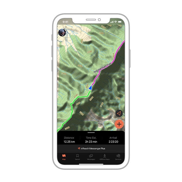
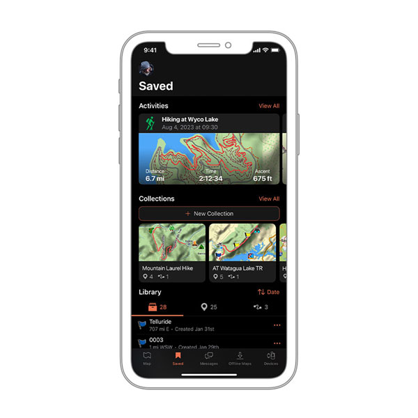
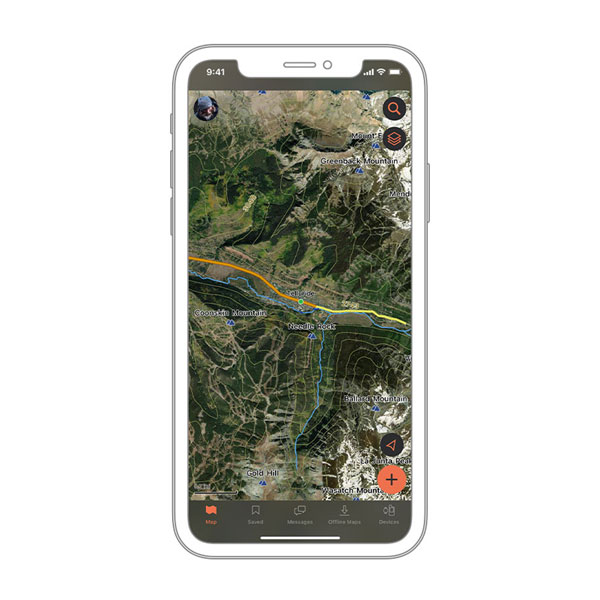
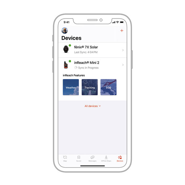
Garmin Explore App
Garmin Explore App
Garmin Explore App
Part Number
010-EXPLR-00
BUY NOW